We enjoyed our lunch sitting out on a rock. The tide is out. We come back another day and this cove is filled with water. Only the very tip of this rock is visible.


 This will all look so different when we come back another day and the tide is in.
The bottom of the falls. We are going to walk up along side it to see if we can find where it begins.
The trees are so tall. This is an ancient forest.
 Bear markings on a tree.
 This is the path along side the waterfall/creek. It goes UP, but is not too steep...but just keeps going UP.
When the going got steeper there were steps of a sort.
Juel leads the way. She is always quite a ways ahead of me. But I keep stopping to take pictures.
We are getting up pretty high. Here we are looking down at the creek, above the falls.
These trees are huge.
Many of the trees are so interesting, besides being tall and big around. Here is a close-up of this one. I think it looks like a face.
Mushrooms growing on an old fallen tree. I read that these are called "nursery trees." When they fall and decay they provide the nourishment for mushrooms, flowers, and new seedlings.
The creek through the trees. Even when we could not see the creek/rapids we could hear them.
The creek split around this large rocky spot.
Heading back down. Going down was so much easier.
More mushrooms.
These "hosta-like" plants are HUGE!
Lunch Creek Bridge...

One last look at the falls.
Looking off the other side of the bridge, out to the ocean.
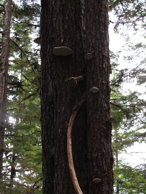
Another interesting tree, this time with a type of mushroom growing on it. Juel says that the natives collect this type of mushroom and smoke it.
Juel is collecting barnacles for Logan. These stunk up our kitchen before she finally got them shipped off to him. She even found a tiny live crab when she rinsed them off at home.
That is the rock we sat on to eat our lunch. Another day when the tide is in we will only be able to see the very tip of it.
Barnacle covered rock.
My footprint in the sand.
Looking out to our "lunch" rock.
Leaving Settler's Cove and heading north to the END of the road.
This is as far north as the road goes!
The Alaska Fireweed is "Alaska's Calendar." The Fireweed blooms from the bottom petals and works its way up. As the petals open over a few weeks, it eventually becomes "topped out" and Alaskans regard this as the sign that summer is nearly over. We have seen this along all the roadsides right now.
Right now these daisies are also EVERYWHERE...along roadsides, in gardens, along the harbor.
Not sure what these are but like the red/orange color.
More fireweed.
2nd Waterfall Creek. Obviously, they count as you are heading north from town. We are now heading south back to town and hit 2nd before 1st.
Heading in to Salmon Falls Resort. Here is their harbor from above.
The resort.
Salmon Creek empties into the ocean.
I love these hangings. I have been collecting driftwood, so maybe I can make one when I get home.
Every business has its totem poles.
Another carved bear...
Leaving Salmon Falls Resort. I never get the signs on the way in...
Heading south again. Here is 1st Waterfall Creek...
We see this house on the island every time we go by Ward Cove. We also saw it from the ferry on our trip to Sitka. I have taken its picture many times, from many views. Here it is at low tide.


This is great!! Way to go for taking a posting so many pictures, it's a lot of work!
ReplyDeleteWasn't sure if you knew the names, so just in case here they are, the big "hosta-like" plants are skunk cabbage (and they are huge back there!) and the mushroom things on the trees are bear bread. When I was a kid we'd collect the bear bread, dry it and paint on it, My husband's grandma would paint and carve them.